UFD Lab CCNY — Harlem, New York

Projects

Four connected questions about the urban atmosphere. We measure on the street, look down from orbit, and simulate the flow in between.

Index of projects

05 entries
No.ProjectThemeMethodsWithYears
01HighRes Urban SimulationBoundary layerLES (PALM), WRFDOE RENEW[Years]
02Harlem Heat ProjectUrban heat islandStreet sensorsHarlem Heat Project[Years]
03TEMPO for NYCAir qualitySatellite data, MLNASA TEMPO[Years]
04Urban AQAir qualityuWRF-Chem, 4 km[Partner][Years]
05[Project title][Theme][Methods][Partner][Years]
01

HighRes Urban Simulation

Boundary layer
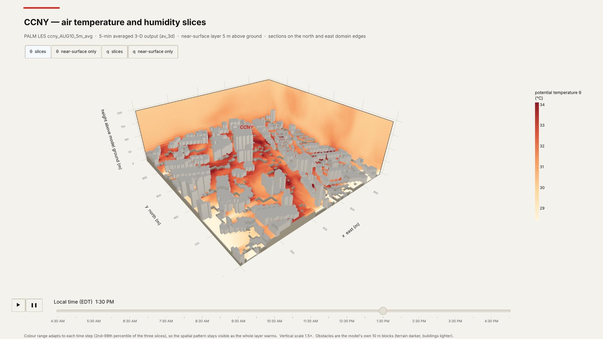
Fig. 1.1Winds in the 3-D domain, 5 AM–5 PM, 10 August.
Question

How does air move through the campus streets and courtyards, and where do heat and pollutants get trapped?

Approach

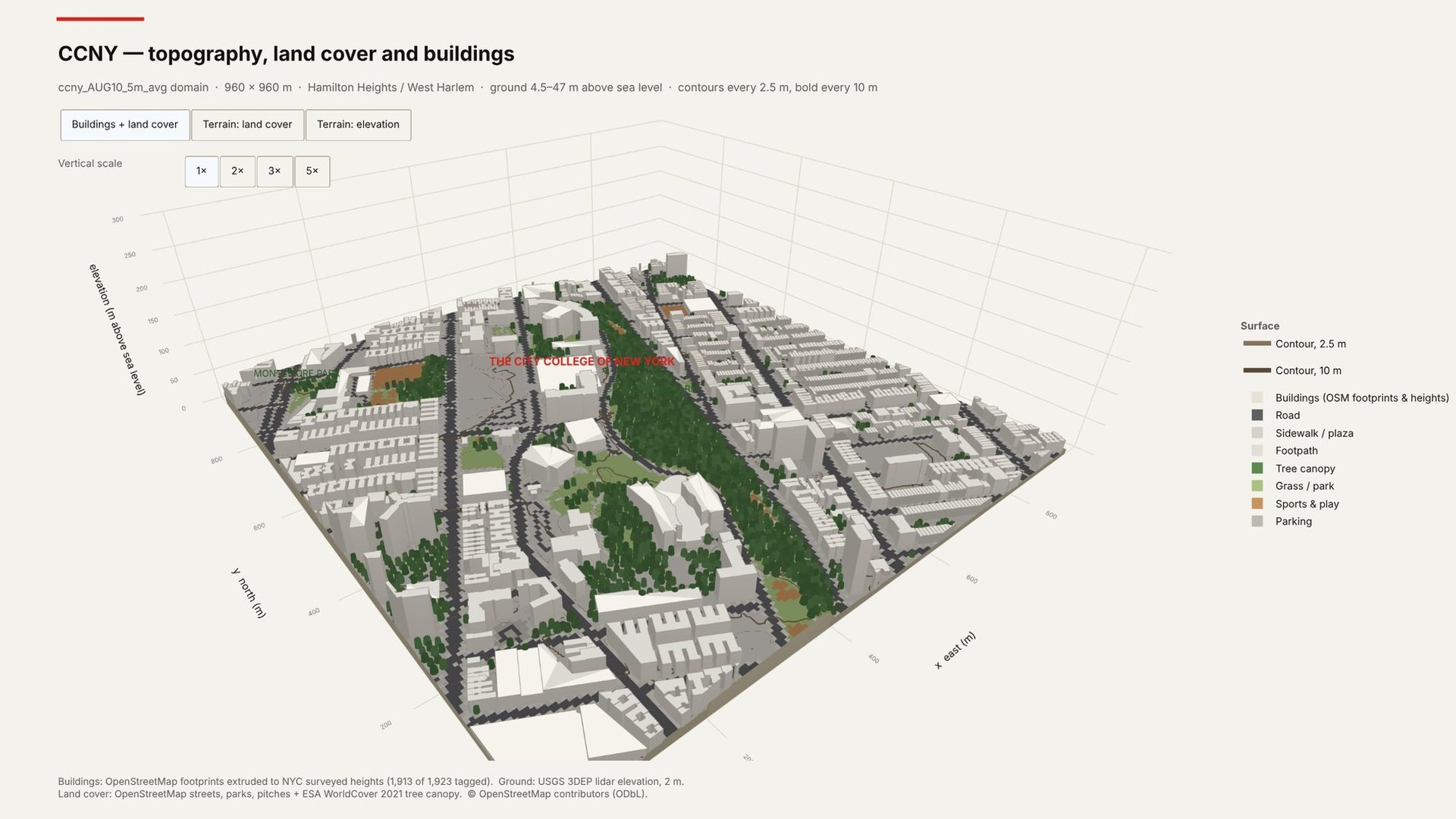
PALM large-eddy simulation of the real campus: buildings, trees and land cover on a 960 × 960 m domain from the ground to 300 m, driven by 100 m WRF. Simulated day: 10 August, 5 AM to 5 PM.

Team

Ethan Hack-Chabot (PhD) with Jordan Eissner (Postdoc) · Funded by DOE RENEW
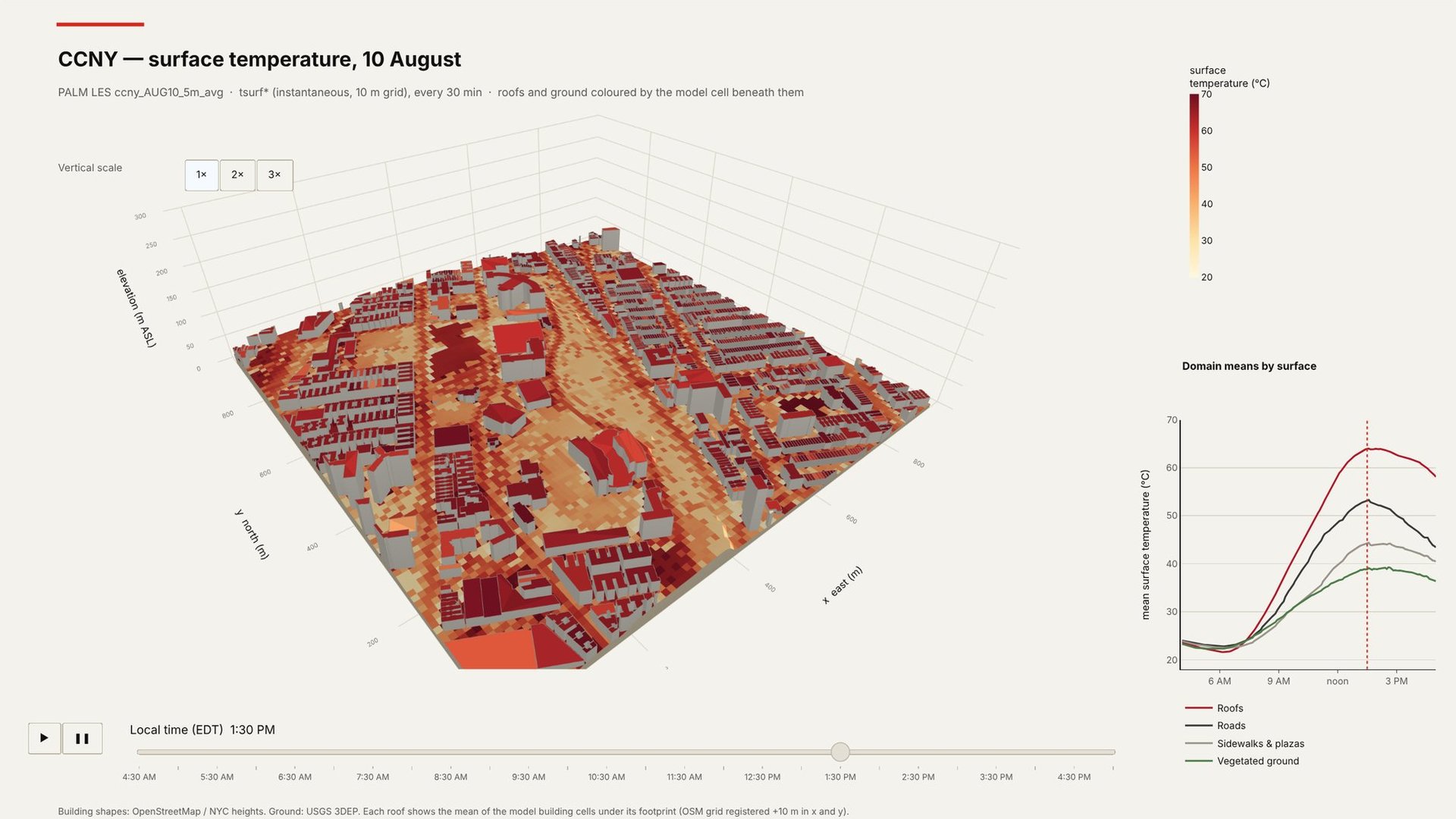
Surface temperatureAir temperature slicesTopography, land cover and buildings
02

Harlem Heat Project

Urban heat island
[Street photo or temperature map]
Fig. 2.1[Caption]
Question

Which Harlem blocks run hottest in summer, and how does that heat reach people indoors and on the street?

Approach

[Sensor deployment, community partners, period.]

Team

[Names]

03

TEMPO for NYC

Air quality
[TEMPO NO₂ column vs. predicted surface field]
Fig. 3.1[Caption]
Question

Can hourly satellite views of the atmosphere tell us what people breathe at ground level?

Approach

A foundation model trained on NASA TEMPO observations to predict surface concentrations. [Inputs, targets, validation.]

Team

[Names]

04

Urban AQ

Air quality
Urban AQ explorer
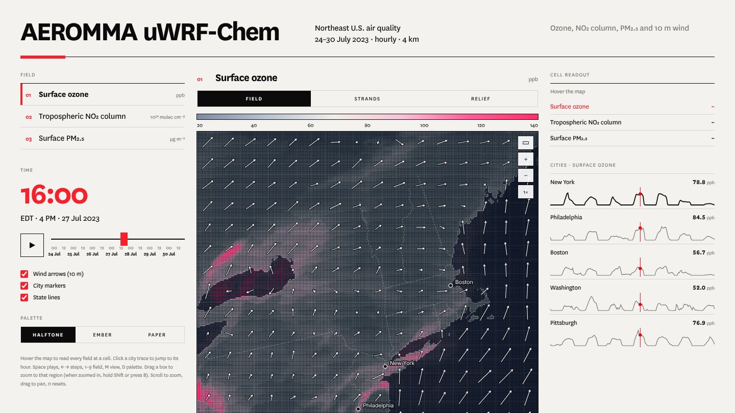
Fig. 4.1Interactive explorer: ozone, NO₂ column and PM₂.₅ with 10 m wind, Northeast U.S., 24–30 July 2023.
Question

How does air pollution change from one street to the next, and who breathes the worst of it?

Approach

[Sensors, models and data used.]

Team

[Names]